
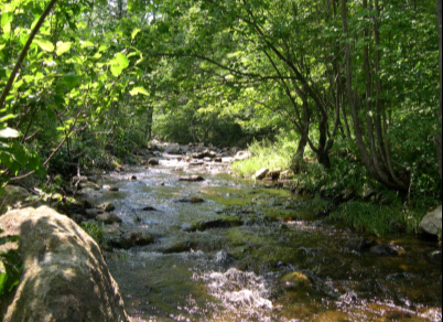
MT. HOLLY VT-155
BF 0133(12) Mt. Holly
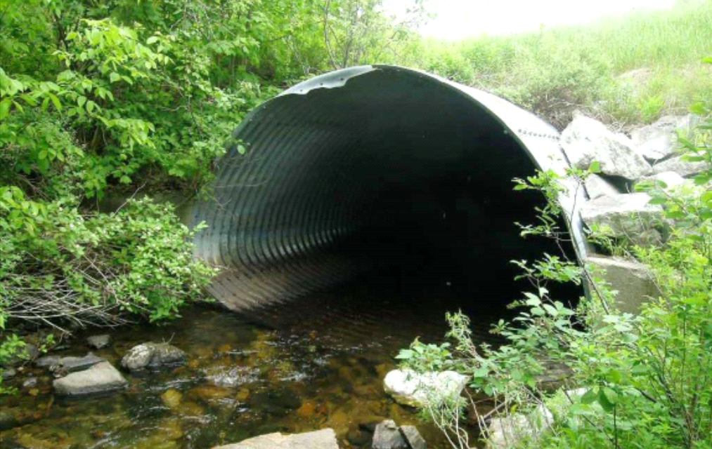
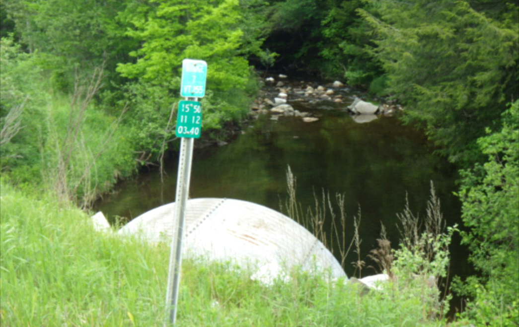
REMOVE AND REPLACE EXISTING CULVERT WITH A NEW METAL ARCH, BR7 ON VT155 IN MT. HOLLY OVER THE MILL RIVER.
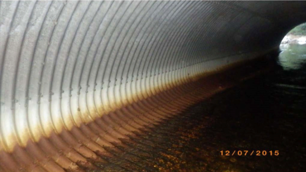
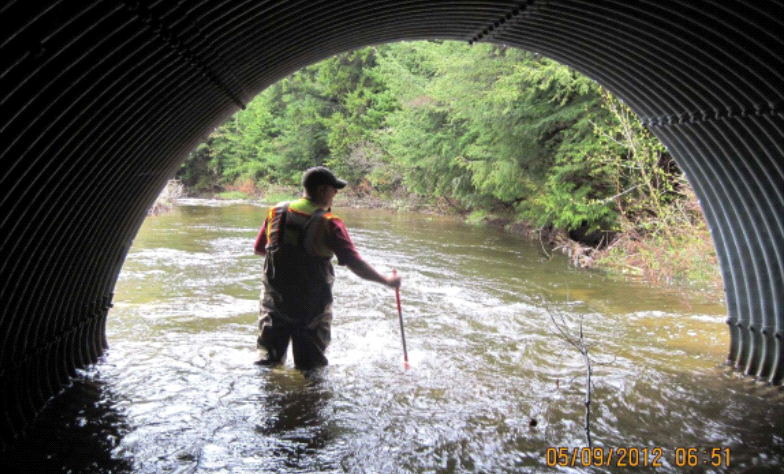
The Mount Holly Bridge 7 project includes the replacement of the existing multi-plate steel pipe arch culvert. The existing structure has a clear width of 15’ – 4” and a clear height of 9’ – 3”, providing a waterway opening of 109 square feet. The structure currently has a rating of 4, poor and has cracking along the bolt line. This culvert was installed in 1969 and is 104 feet in length. There are signs that the outlet end of the culvert is deforming and settling due to perforations in the invert, leading to scour and undermining beneath the structure.
VTrans evaluated alternatives for rehabilitation or replacement of the culvert in an engineering study completed in April, 2017. This study assessed the proposed design criteria for the structure, right-of-way, rare/threatened/endangered species impacts, hydraulics, archaeological resources and wetland impacts. Several alternatives were considered, including: no action, rehabilitation, replacement using trenchless technology and replacement using an open cut. Finally, complete replacement was considered using a short term road closure with a detour, temporary bridge, or constructing the new culvert in phases while maintaining traffic through the work zone.
Given the age of the structure, site constraints and current conditions, the engineering study recommended replacement of the culvert with an open bottom concrete arch or frame while maintaining traffic on an official signed detour. Closure duration will be approximately four weeks in which the detour will add approximately 8.1 miles to the thru route. There is also a local bypass route, adding 1.2 miles of travel for thru traffic.
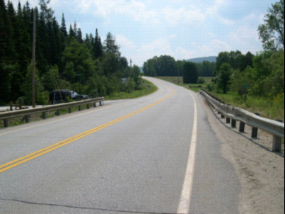
The existing roadway meets most of the geometric provisions of the Vermont State Standards. The horizontal alignment is the only known roadway deficiency within the project area. As this is not a high crash location, no changes to the roadway are proposed for this project.
Detour Route:
This option would close the bridge and reroute traffic onto an official, signed State detour. Traffic will be routed southward on VT 155 from the project site into the town of Weston. The route turns north-east on VT 100 and proceeds through a small corner of Andover into the town of Ludlow. Traffic continues on VT 100 into the village of Ludlow, where VT 100 becomes TH 2, Andover Street, Class 1 paved. The detour turns westward onto TH 1, Main St., Class 1 paved. TH 1 becomes VT 103 heading westward back into the town of Mt. Holly and through a small section of Wallingford, where it intersects VT 155 again.
| Thru distance | 10.4 miles | 14 minutes |
| Detour distance | 18.5 miles | 24 minutes |
| Added distance for Thru Traffic | 8.1 miles | 10 minutes |
| End to end distance | 28.9 miles | 38 minutes |
.PNG)
Link to project sharepoint site: https://outside.vermont.gov/agency/vtrans/external/Projects/Structures/12c594
Closures:
- VT-155 will be closed for 28 days between July 21, 2020 and August 18, 2020.
Contact Information
**Please note: Contractors are to direct all inquiries to Contract Administration during project advertisement.
VTrans Project Manager
Robert Young
(802) 595-2358
rob.young@vermont.gov
VTrans Resident Engineer
Elizabeth Craffey
elizabeth.craffey@vermont.gov
